The Mogollon Rim Trail


Intro: The Mogollon Rim
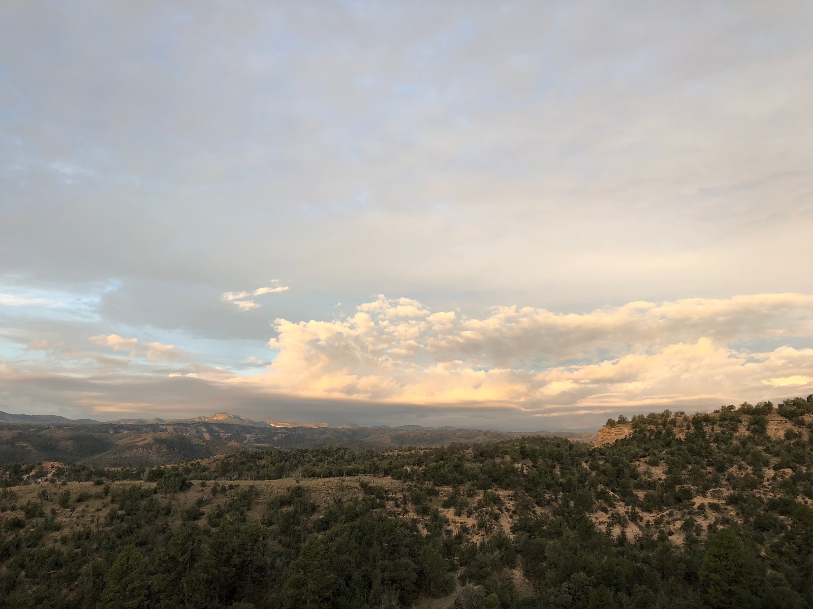
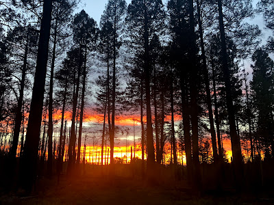
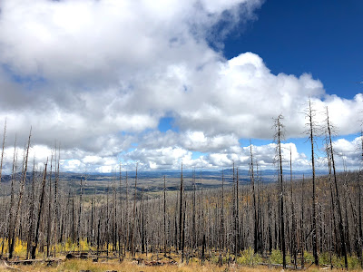
The Mogollon Rim is an enormous geologic feature roughly from the Mogollon Mountains in western New Mexico to Seligman, Arizona. Ending points of this escarpment seems to be fairly vague but the rim is pretty well contained in the parameters above through central Arizona. However, the rim acts as a long east-west line with a northwest-southeast trajectory and boundary of the Colorado Plateau to the north and the Madrean Sky Islands and deserts to the south. Because of the divisive nature of the Mogollon Rim the landscape and the flora and fauna are diverse. On the top of the rim, which ranges from 6500ft to over 11000ft, the area reeks of the Rocky Mountains. Huge herds of elk with the bulls having immense antlers roam the grassy meadows, the elk bugle into frosty Fall air sheering the silence with a sing-song trance, the aspen shiver and tingle in the breeze, and the air chill and sink in the meadows. Sunsets are blazingly stunning and the grassy plains to the north are pockmarked with cinder cones and sweeping views. Wild horses roam the rim in the higher country, a large population of bear roam wide, and even the occasional howl of a Mexican lobo persists and cuts through the thick night blackness of air. Below the rim, which hovers roughly between 4000ft and 6000ft, with an occasional uplift to 8000ft, the escarpment is rough country full of overgrown trails, spiny and pokey brush shred the hiker, and water can be a scarce commodity for the high desert traveler. Most impressive, above and below the rim, is the largest and continuous ponderosa pine forest in the world. The ponderosa smother the central and northern part of the state. Another feature of the rim, and in particular of the people of the rim, is the presence and reality of wildfire. Monsoonal storms flow with ferocity towards the rim, then abruptly erupt high into the cumulonimbus heavens. When the storms hit the rim they are ready to project lightning and spill downpours. In dry years, fire and smoke has dominated the skyline. But the landscape and the people have endured. Being weathered out hear has meaning, with the common presence of fire the Mogollon Rim is the milieu of the rim people.
The Route: The Mogollon Rim Trail
The MRT is a route in its infancy, a route designed for the hardiest of hikers, for ones seeking a unique experience in a vast landscape interweaving among the Mogollon Rim. Not surprisingly, the concept and route idea spawned from Brett Tucker, an inventor of long distance routes around the wide open Southwest.
The Mogollon Rim inspired Tucker to create a route that at one point was considered as a possible northern route for his Grand Enchantment Trail. Ultimately, due to land issues, more landscape diversity, and the connection between the two major Southwest cities of Albuquerque and Phoenix he chose the southern route we see today starting/ending in the Superstition Mountains. In fact, the MRT diverges with the GET at Sunflower Mesa on the NM/AZ border.
I have a faint memory of Tucker writing to me about this route many years ago, probably after my Vagabond Loop in 2013. However, in 2016, the MRT was the missing piece for a giant year of hiking for me. I wanted to bookend a PCT nobo and a CDT sobo with the Sky Islands Traverse and the MRT. Unfortunately for me, wear and tear in the form of food poisoning and kidney stones did me in and I had to set aside the hiking plans of the MRT. Ironically enough, the day I decided not to hike further that year, Tucker and Tree passed along the MRT info. I was pretty bummed, but I always knew I would get my chance to tramp the rim.
Mileage and Termini:
The MRT’s mileage is still not set in concrete. As with most routes, most mileage changes, grows, or seems off. Some of this discrepancy can be from having unintended ambiguous termini. Other ways of mileage and measuring being off is not having on-the-ground field-truthing. Some trail sections, for instance the Highline section, has been rebuilt and engineered to increase the mileage data in that section. The rebuilding of trail in that area will ultimately benefit hiker in the form of easier walking but mileage data may continue to change as more improvements are made. The vetting of the route was done by Tucker himself and/or Tree by either hiking some of the sections piece by piece or by Tucker’s obsessive diligence in scouting over satellite images. The eastern portion of the MRT in the Blue Range Primitive Area and the Bear Wallow Wilderness have yet to be completely vetted on the ground by Tucker, however, a long distance hiker by the name of Bernie hiked intrepidly into these areas with little to no updated info in 2016. His water info proved invaluable.
Insomuch the MRT extends from the Mogollon Mountains in western New Mexico to Cottonwood, Arizona. The eastern terminus can be identified with the Catwalk at the mouth of Whitewater Creek in the western portion of the Mogollon Mountains. Arbitrarily, Lint and I started at the Gila Cliff Dwellings and crossed the whole Mogollon Mountain range. The main reason being so that I could cross a namesake range that eluded me in ‘13 while on the GET due to severe flooding and fire damage. I saw this hike and time as an opportunity to experience that area that could possible tie into the ‘Mogollon theme.’ So, we walked an extra 60m or so to extend our trip to get to Sunflower Mesa where ultimately the MRT becomes completely independent of the GET.
The western terminus is clearly defined by the Parsons trailhead near the confluence of Sycamore Creek and the Verde River. After enduring the Sycamore Canyon Wilderness one would pop out into a finish line worth seeing, one that makes one feel like they have accomplished something. There is an exception or an extension as well. 14 or so miles from Parsons is the Jail Trailhead bear the Tuzigoot Monument and Dead Horse State Park on the outskirts of the town Cottonwood.
So, finally I’ll get you some mileage numbers, or at least close to what we actually walked. According to the town guide and GPS waypoints, the MRT from the Catwalk to Parsons trailhead is ~485m. If you extend the hike to Cottonwood, then the mileage is ~500m. We started at the Gila Cliff Dwellings tacking on roughly ~60m, so we tallied ~560 or so miles. Here’s the funny part. Now, if you take into consideration the mileage discrepancy with new trail having been built and for a ‘red line’ on a map not being completely tracked, I think it is fair to say we hiked close to ~570m to ~575m.
Whew! That appears to be a lot of gibberish, but maybe this will show the user and reader how much goes into a route before it is released to the thru-hiking public.
The Challenge:
A quick note:
This is not a route for a novice hiker. This route in its totality will push you. As of now, the GPS and Town Guide is by invite only. Navigation and route finding skills are a must. Thwacking through fire-ravaged country with little or no trail among thorny and spiky brush or cactus is fairly common. Wading through water, rock hopping, crawling over logs, and dealing with inclement and stormy weather are natural characteristics of this trail. This route is as difficult as the GET, although shorter in length.
We are not trying to dissuade a hiker, only to be transparent and upfront about the route. As of now, besides Lint and myself, who have thousands upon thousands of miles in shitty conditions, Bernie Krausse is the only other thru-hiker of the MRT, who actually is the first person to do so. He also has a plethora of outdoor knowledge and skills, among thousands of miles under his belt, to have helped him achieve this route.
Any questions on this route, please comment below and I will get back to you, or go to Brett Tucker’s website simblissity.net for further information and updates.


Interwoven Hiking: The Flow
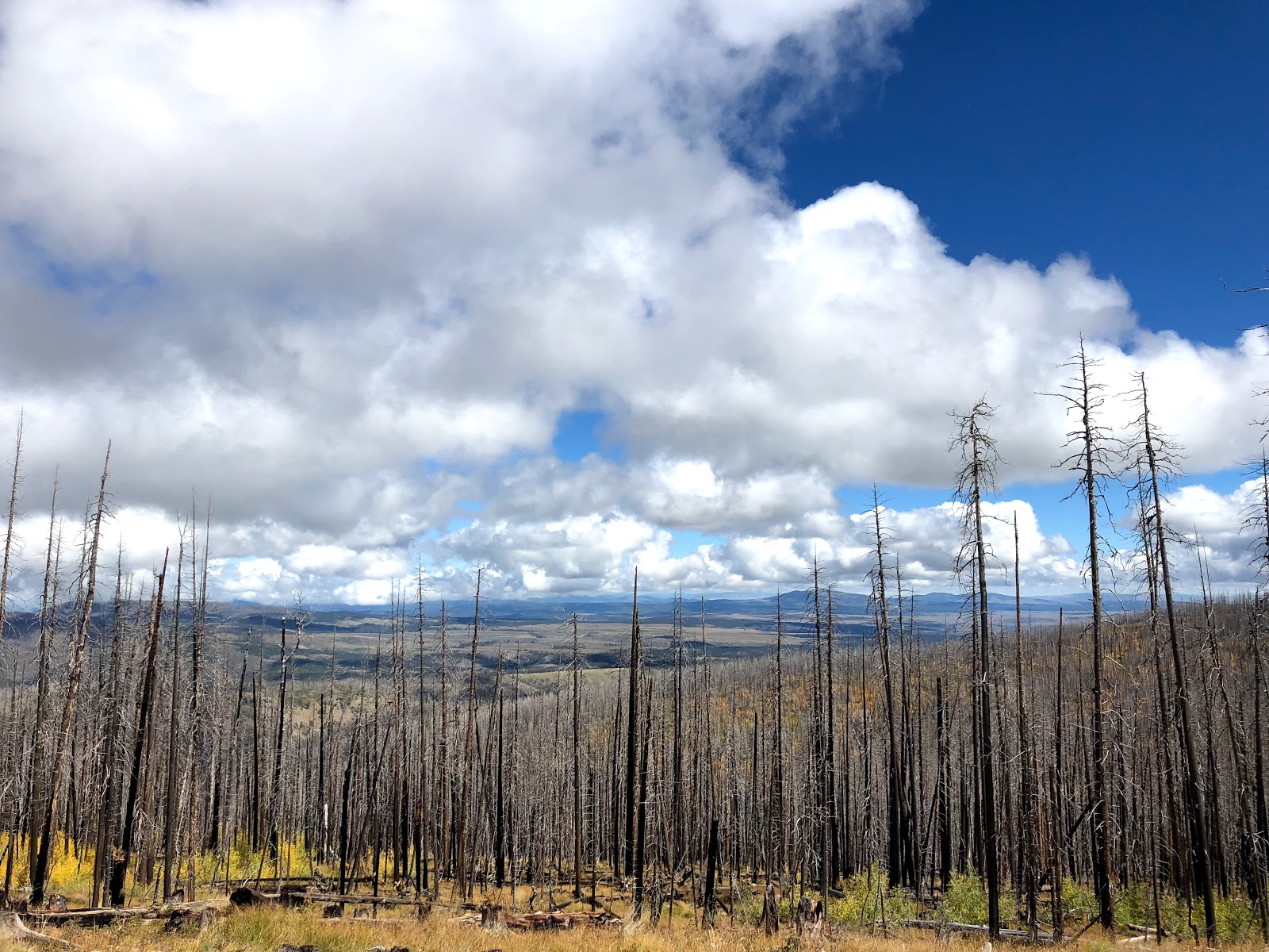
The Mogollon Rim lended a thematic and challenge flow to the MRT overall. Bear with me here as I explain. The landscape provided a major theme in the form of the rim itself. Trails, whether ‘good’ trail or ‘bad’ trail, little used dirt roads, and some cross country, all weaved above and below the rim. Hard, easy, then hard, the route denotes the character of the rim, showing the stability and balance between civilization and wilderness. Where the rim is inhabitable communities thrive and the White Mountain Trail System interlocks the towns. On the eastern and western edges of the route the landscape is very rugged. Extremely rugged would actually be more appropriate, especially with my tendency for hyperbole. However, I’m not doing the Mogollon Rim any justice by selling it short by not being accurate in describing the rugged characteristics of those places. For example, the Blue Range Primitive Area is as wild and rugged as the GET’s section slightly south of the MRT’s route. In fact, even more so.


You see those black dotted lines on the map that define a ‘trail?’ Yea, those aren’t always in truth anymore. What I think I am most fascinated by the spirit of wilderness is its impermanence, the constant state of change while not being too different than what a particular place actually is. I admire the flexibility and adaptability of these changing places and I am investigatingly curious to read the changes in the form of fire-ravaged land or water erosion, or old corrals, or old maps with outdated dotted lines.
So, with this in mind, here’s the theme of ‘hard, easy, then hard:’
Having scoured our way through the Blue Range Primitive Area, with a thorough divulgence in the Little Blue Creek area and the surrounding basins and canyons, the Blue River area, including a long ascent up the long tributary of Strayhorse Creek, we plunged into the headwaters of Eagle Creek. We thrashed our way up and down these areas following scarce trail and the occasional cairn probably built many, many years ago. Fire-scarred, brush and plants that thrive in fire disturbed soil posed the thorniest option. There was no way around it; just go through it. Old remnants of a past ranching culture posed in sunken fence rails and rusted barbed wire constructing an old square now lack in rigidity. In its isolation, the Blue Range Primitive Area held herds of elk and bands of coati. Tarantulas crawled in migration to who knows where. Water settled in the deep recesses of slot boxes and flowed down chunky rock bottoms.
The difficulty continued in the Bear Wallow Wilderness. Although huge pockets and forests of ponderosa pines exist, it is hard to ignore the fire scars of the past. In this instance and our timing, inclement weather greeted us and we had to make an important decision to not delve deeper into an area with a high potential for flash floods, as well as a high chance of hypothermia in the wetness that existed and the temps that persisted. We missed the heart of that wilderness in Bear Wallow, but in the aftermath of the storm and seeing the snow totals, no doubt we made the right session.

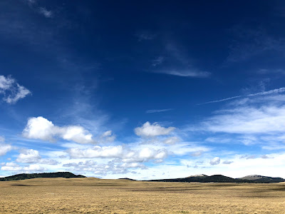
Nevertheless, the route continues up to the high point of the White Mountains at 11400ft in Baldy Peak. (Please be aware that the actual peak is on the San Carlos Indian Reservation and a guide is required to actually summit the peak. The MRT stays on National Forest land just outside the boundary). After the trail goes up and down the east and west forks of the Little Colorado River, the MRT hits the Apache Rail Trail and things become easier. You feel like you can take a big breath and let the legs stride open. You are now in alpine country and huge meadows welcome you with flat walking, aspen tingle in the breeze and a sense of calmness entrance you as you now pick up the pace to 3.5-4 mph versus the 2mph in the most rugged of places in the previous days. Evidence of civilization show you are not alone. Roads and trails are signed, established camp sites entice a wearied hiker, and mountain bikers weave through rolling and groovy singletrack. It felt just a relief to be among the Rim Country and its network of trails and road that bring users together. On a low ridge following trail in thick forests on a chilly morning you almost forget you are so close to the rim proper and above a high desert environment. Besides the obvious abrupt escarpment on the map, the only way to know the rim is near with the locals who refer to ‘The Rim’ as if it’s another person we all know, like a common bond or thread that seams our connection.
Then, you plummet down the rim, as the wind hollows out a vacuum of sound, pulling your person down like a palpable gravity. It’s a gulp of air, the sucking of a wall ominously standing over you, and the collapse of biospheres showing the drastic change between a landscape barrier. The Highline Trail dreamily whips for roughly 60m. The rim dominates above you, hulking over the top of you as you are constantly reminded of an entity that rules an area. In Pine while enjoying a beer, you feel grateful for that fun and easy stretch that pumped you full of oxygen from that sucking wind. Leaving Pine things change again. The rim is omnipresent but the rock is changing becoming more red and sandstone like.
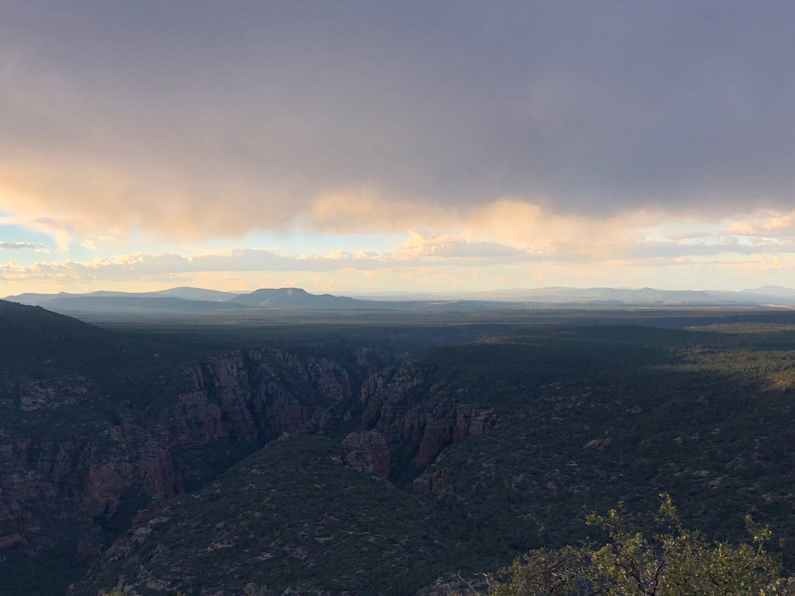
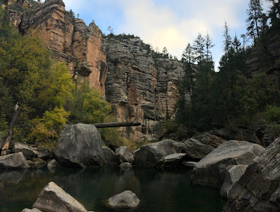
Instead of being immersed on top of the rim in flat expanses, the route themes towards the bottoms within the towering walls of a canyon. West Clear Creek, although a short difficult jaunt, you are afforded the smooth walls of varnished rock. You wade through the clear water and thrash through willows at about 1m per 45 minutes. It is really hard not to go slower though, as you are caught up in the splendor of the canyon. Up on the mesa, even with open dirt road, the easy is not that going. Bulky volcanic rock clogs the little used dirt roads making for slow go. You have to pump the feet to move quick to maintain a fluid pace. This is hard work, for anyone. Nevertheless, sweeping views reward the traveler. Ever rosier red rock tantalize you as forward progress is slowly attained. Wet Beaver Creek is achieved after a steep and well-engineered descent via old cattle trail.
Things get good from here and the ‘trail’ becomes ‘hard.’ But the motivation is there. The wildness is there, a deep wilderness, but the scenery is jaw dropping. We took a dip in Dry Beaver Creek and felt completely isolated from everything. In the heart of Red Rock Country most of the trail is red compacted sand with occasional jaunts on pink sandstone under towering turrets and pinnacles. A long and etching descent up Loy Canyon terminates at a narrow saddle separating islands of mesas.
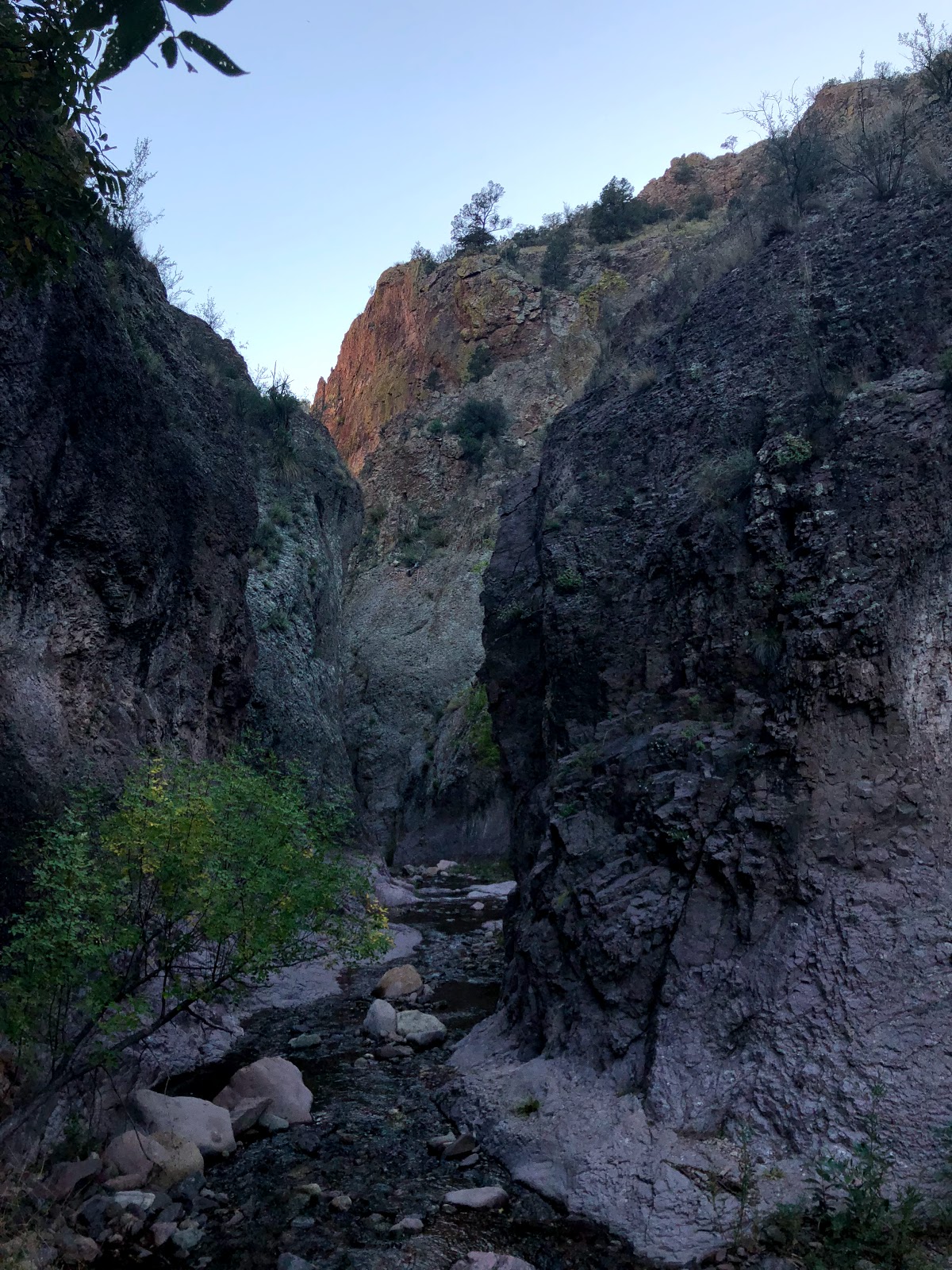
Sycamore Canyon Wilderness encompasses the character of the MRT. I felt haunted with wildness, like a spirit took control of me. The technical descent into Sycamore Canyon proved challenging. However, what really got me was the rock hopping in the bottom. Total concentration is needed as the blueish hues of the boulders clog the creek channels that show the flow of flash floods. The energy of this canyon you feel the immense power of the wild. And you feel the reward of a ‘thru-hike’ becoming near, the sense of accomplishment through a challenging environment tickles the taste buds of adventure.
That’s the theme. Writing this I am as motivated as ever to get back out there. You feel it?

Direction:
The MRT Town Guide and the waypoints went west to east, from Cottonwood to the Catwalk. We went east to west, from the Gila Cliff Dwellings to Cottonwood. I chose this direction mainly for 3 reasons:
•harder access to the eastern terminus, to get the difficult hurdle of ruralness out of the way.
•to hike the higher country during the warmer time periods. Although this proved to be an ineffective strategy with an extraordinarily wet Arizona October, I would do the same again in a different Fall time of year.
•I really wanted to finish in the Sedona area. The towering red rock and exquisite scenery provided a warm and fuzzy feeling as I revisited an area I hadn’t seen in 20 years or so.
So, reading the maps and waypoints backwards could have potentially got us into trouble in regards to water carries. Lucky for us, this past October was one for the precipitation record books. The other challenge in this is that I had to keep looking ahead on the waypoints for road or trail numbers. Again, this route is in its infancy. So, the resources for this route aren’t completely finished or updated or haven’t been vetted. Lint was a good sport about it, as we both took it in stride.
 Lastly, due to severe inclement weather we had to do a flip of sorts, which Tucker perfectly dubbed the ‘Pineflop.’ When we decided to avoid the Bear Wallow area due to flooding, cold temps, heavy snow and rain amounts, the duration of the storm, and the technicality of the route we decided to hitch from a forest road to Alpine. Realizing how hard it would be to get back where we had hitched from we ended up hitching to Pinetop, some 100 trail miles further west. Pinetop had more amenities for us to wait out the storm, as well as being more advantageous for us to get as much trail completed with the snow amounts that fell figuring the extra day or two would help melt out some sections. Also, we knew that ultimately it would be easier to hitch out upon reaching our connection point. Ironically and interestingly enough, this decision, not only a vital safety one, this ‘Pineflop’ helped me garner more knowledge of the Mogollon Rim itself, as well as the people. See the Highlights section for the quick story.
 Lastly, due to severe inclement weather we had to do a flip of sorts, which Tucker perfectly dubbed the ‘Pineflop.’ When we decided to avoid the Bear Wallow area due to flooding, cold temps, heavy snow and rain amounts, the duration of the storm, and the technicality of the route we decided to hitch from a forest road to Alpine. Realizing how hard it would be to get back where we had hitched from we ended up hitching to Pinetop, some 100 trail miles further west. Pinetop had more amenities for us to wait out the storm, as well as being more advantageous for us to get as much trail completed with the snow amounts that fell figuring the extra day or two would help melt out some sections. Also, we knew that ultimately it would be easier to hitch out upon reaching our connection point. Ironically and interestingly enough, this decision, not only a vital safety one, this ‘Pineflop’ helped me garner more knowledge of the Mogollon Rim itself, as well as the people. See the Highlights section for the quick story.
Duration:
We completed the roughly 570m in 22 days, with an average of 25.9mpd. We really tried to push our feet a bit while walking 11 hours of day in the 12 hours of daylight available. That being said, in the difficult sections expect lower mileage per hour, while in the easier sections you can expect realistic thru-hiking speeds. We had a couple grueling days with a couple memorable days of 22m or so that took all day to accomplish. Some sections in those days were if the bushwhacking sort that gave us a slog at 1-1.5mph.
Water:
We had a freakishly wet October. So, water was abundant for us. That being said, the water sources on the rim, mainly earthen tanks, were silty and muddy making them almost unpalatable. The rains flooded the ponds and became tainted with dirty run-off. The eastern side seem to have reliable sources and running creeks, although this may be favorably influenced by the wet October. The western side had so much water that the places we found water are totally to be unexpected in most years. The tanks seemed too silty to drink but we were spoiled by the even smallest of ravines and drainages that held pools of rainwater. I would expect to find the biggest of water carries in the western side from Pine to Cottonwood.

Water waypoints, concerns, and updates are in the GPS tracks. However, that is available by invite only, as of now. Please be aware the water levels are highly based on monsoonal flows and tendencies. So, the years and time of year are variable and are dependent on these flows. Natural water sources are rare on this route, especially up on the rim proper. Also, even more importantly, the water sources in this sensitive ecosystem are fragile and vitally important to the wildlife also using or living in the source. Please practice LNT ethics and only use what you need.
Timing:
There are realistically two seasons to hike the MRT, Spring and Fall.
Bernie hiked the MRT in the Spring months, I believe late April to May. This timeframe seems logical and I bet the plant life is a bit lush and green typical of a desert springtime bloom. Daylight is ample, but the mornings cool and even cooler up in the alpine country. Snow would probably linger up in the alpine country as well, especially around the Baldy Peak and Greer areas.
I chose the Fall as I wanted to have a desert type Fall hike. The silence, the lonesomeness and remoteness all entice me for desert Fall hike. However, the MRT is enhanced by this timeframe with the rut of the elk, the changing of the colors of the leaves of aspen and the cottonwood. Even the gambel oak and sycamores show some brilliance. The air is heavy and humid and one can expect to be sweaty on the warmest of days. The shorter days and longer nights are an aspect I relish in for a Fall time hike, a way to reflect on a hiking season while resting up a bit with lots of recovery time in the long nights in a changing season.
Although one could feasibly attempt a thru-hike in the summer months, I do not recommend this notion to the fickleness of water and most hikers’ experience levels.
Resupply and Resources, Maps:
A map set has been compiled by Tucker, including a GPS track. However, as of now, vetting of the trail is in progress and only available by invite only. The map set and GPS track read in a west to east direction. Please, be mindful of that in regards to water sources, trail and dirt road numbers, and mileage. If you are interested in this information please email Tucker.
Tucker has completed a thorough Town Guide to provide the hiker with details on resupply. I used this to develop an itinerary that seemed most sensible. However, after hiking the MRT I would do things a bit differently. Please email Tucker with questions or how about attaining this Town Guide.
I will list my itinerary below, based off what we hiked, east terminus to west terminus, and suggested resupply and postage. I won’t include mileage though, only section point to section point, our estimated duration between sections, section difficult rating, and recommended and/or what we did there. I will keep this somewhat brief, but hopefully this will give the future hiker a template to go off of.
•Gila Cliff Dwellings to Glenwood
 •Greer to Lakeside
2.5 days, moderately difficult
Grocery store in Alma, PO in Glenwood
•Glenwood to Greer
6 full days, very difficult
Small grocery store in Greer
 •Greer to Lakeside
2 days, easier difficulty
Grocery store in Pinetop, maps to PO
•Lakeside to Forest Lakes
3 days, easier difficulty
Small grocery in Forest Lakes
•Forest Lakes to Pine
3 days, moderately difficult
Grocery store in Pine
•Pine to Sedona
3.5 days, very difficult
Grocery store in Sedona
•Sedona to Cottonwood
2.5 days, very difficult
Grocery store in Cottonwood
Highlights:
•An impact directly borne of the aftermath of the MRT became apparent the more I spoke of the route. This notion actually became apparent during a hitchhike with a rancher from Douglas, AZ. We spoke of southeast Arizona and the Chiricahua and Dos Cabezas Ranges nearby from where he was born and raised. Anyways, all this rambling leads me to a reflection on all this exploring of Arizona and how the impact of Tucker’s route inventions has influenced my life over the past 5 years.
I feel lucky and grateful to reap the benefits of Tucker’s ideas and hard work over the years. I feel like I know Arizona, especially southeast Arizona intimately and my connection to that landscape runs deep. From my Vagabond Loop (AZT and GET), the Sky Island Traverse, bikepacking the AZT, and most recently the MRT the miles seem less important as the time spent immersed in this very beautiful state.
I am still being drawn back. I am not sure when, but I am sure I will be back soon to Arizona. A special thanks and unending gratitude to Tucker for his direct impact on my life.

•The ‘Pineflop.’ I struggled with this decision. And before I go any further, a big thanks goes out to Lint for being so flexible with my plans and the weather, as well as me taking my time to make such a tough decision when I was battling with my integrity and my sensibility. In the end, I know it was the right decision. But the unperceived benefits afterwards became invaluable for my time spent out there on the rim.
The flop helped me gather a broader and more intimate understanding of the Mogollon Rim area. Like the hitchhiking broaden familiarity and brought a bearing to my inner compass. During the rides I suddenly became aware of the vast complex of the rim, the impact of the rim of the people, the character not only of the rim but the people themselves; the flop tied all the moving parts of a complex movie together.
Most memorable of the flop was the 5-way hitchhike getting back to Pinetop after walking eastward for roughly 90m. The first ride was with the rancher, Jerry, I alluded to in the previous highlight. He dropped us off in the small town of Alpine after a 45 minute ride. Storytelling of this isolated landscape in great detail only brought my curiosity to further deepen for this area.
The second ride came from a grizzled old man of the woods riding in a Mercedes Benz sedan. The sight appeared weird at first, and we even thought he was drunk. But he had been living in the hills learning the land out here for the previous 5 months. He knew the paths of the elk, had a freshly killed bear in the hollows of the hills, bucked firewood for money, and fondly knew different strains of marijuana. He took us out of his way to a reservoir that enabled us to get closer to our destination.
Next, an interesting ride with an Indian and a bearded aging white make who looked like Abbey in a tweed jacket stopped for us and let us ride in the back of a small Toyota Tacoma pick up truck. They dropped us off in Springerville and bade us good luck. The journey continued with a ride with a couple of paleontologists, including a young man who at a young age discovered a new dinosaur. That discovery now bears his name. He is also an aspiring CDT thru hiker, which we spoke of at length in too little of a timeframe.
Lastly, Rupert from Maine, who now lives in Showlow, stopped for us in his work van. Lint crammed in the back which was separated from the front cab. Rupert’s 3 dogs licked and lapped up on Lint quite comically. We zipped down the highway talking of travels and the friendliness of people. Soon enough we were back in Pinetop and back on schedule. The whole day seemed improbable to me at first, but niceness prevailed. And the experience was fun with a partner, especially Lint who had so much fun throwing his thumb out and flashing a giant smile and a hearty wave to every vehicle that passed, something I am pretty shy to do.
•The ruggedness and the wild spirit of the Blue Range Primitive Area provided an awesome introduction to the MRT. Wading through slot canyons, stumbling across old vestiges of rural ranch life, the wildlife, the overgrown trail and the deep canyons, and the deep blue sky filled the wanderer’s spirit with wild wonder and a yearning to go deeper and further.
•The Highline National Recreation Trail, #31. In recent years, the Highline Trail has seen some serious makeover and maintenance upkeep. The trail weaved and wiggled through steep ravines, gradually climbed and fell through hills and spur ridges, the corridor lopped and logged back to provide a drier experience on a soggy day, and the benches along sandstone with ephemeral pools of fresh rainwater made the 60m so much fun for a trail lover’s heart. Aficionados of well constructed trail will not be disappointed.

Besides the trail magic received from Tucker and Tree on a very rainy and cold night, the highlight of the Highline area was our encounter with a mountain lion. Our timing was just perfect. Lint spotted the lion as I walked up from the rear after a piss break. Otherwise our conversation might have shooed the lion away before we rounded the corner. Not only that, the wind blew strongly from the west which put us upwind from him and caused the ponderosas to sway and shimmer in the wind loudly enough to muffle our footsteps and our arrival. What seemed like a long minute, Lint videoed the lion ambling along the trail. I stood watching in awe as the lion’s tail swayed like a snake charming its prey. Quite realistically lazing along, the lion would occasion stop and look west into the thick forest. The lion’s ears would prick up and his tail would stop in mid air. Quite large, the apex predator eventually jumped off but the exhilaration of the encounter brought out an adrenaline unmatched in most wildlife encounters, a rare one indeed.


•The canyons of West Clear Creek and Wet and Dry Beaver Creeks brought us to deep hideaways filled with raging creeks and soothing swimming holes. These pockets of wilderness really displayed the diversity of Rim Country. Lush canyon bottoms brightened with cottonwood, the creeks jumped with fish. The beautifully polished cliffs revealed the inside cartilage of the shelves of rock. Old trails displayed the evidence of homestead life from many moons ago. These canyons provided an oasis from the drier highlands above.

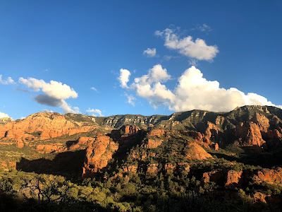
•Sedona and Sycamore Canyon. Many years ago, some 20 years, I tried to explore Sedona with a mountain bike. Yet, spying the town and sandstone monoliths from Munds Wilderness brought a we’ll of emotion out in me. I knew finishing in this area would evoke something high within me, like glee and happiness. Walking through into it and through it, then out of it, is such a more rewarding experience than driving a stinking automobile to it. I simply want me feet to go everywhere to fully experience a place.

One of the most wild areas of the MRT was Sycamore Canyon. Giant sycamores stood corkscrewed yet tall within the gouged flood channel. One of the most rockiest creek bottoms, we hopscotched across blue tinted boulders and above deep recesses hidden among the creek bends under dark pink sandstone. We encountered a couple of ACE trail crews that had been maintaining the first 5m of the wilderness trail. This reward of a clear corridor, we thanked the hell out of the crews personally. Even as we left the wilderness we had a chance encounter with Jason, a Prescott NF Wilderness Ranger, who had been working with the crews. He has roamed and scoured the Sycamore Canyon Wilderness the past 17 years and knew the area so well. Encountering him reminded me of what meeting an Abbey character in modern day life is like.

•Friendship. I have known Lint for years now, stemming from our first meeting on the CDT in 2012. We hiked half of that trail together. Over the years, we have remained very good friends. During that time we both have endured some tough times. Sparing any details, I extended an invite as a feeling of gratitude for his being there for me during my trying time some years ago. I also felt this hike of the MRT would do him so good as a way to escape the fuss and flutter of his trying time. As a Triple Triple Crowner, Lint usually sticks to the Big 3 trails, so doing something like a route, which I prefer, the invite seemed a perfect time to catch up and have a great time walking in an unknown and wild area.
Here's what I will say about friendship: Grace. I think everyone should be granted a little bit of grace. Not everybody is perfect, to say the least. I don't think it is fair to condemn someone who hasn't been told there side of the story. One thing I yearned for during my trying time was not having anyone ask my side of the story, save for my buddy AllGood and Swami. I wanted to do the same for Lint. And this isn't because I believe in all that he believes in. This is the compassion I want to exert to people, especially friends, who have pain or have been hurt. To perhaps provide a friend with an open ear and heart in an open and wild area where you can nearly scream at the top of your lungs and no one can hear you scream your pain, I felt that would be vital for growth, for self-forgiveness, for finding a meaning after whatever you have experienced.
Thanks for the laughs, homie. I hope this trip will be meaningful for you, as it was for me.


Sycamore Canyon:


Sedona:


Munds Wilderness:


Dry Beaver Creek:


Wet Beaver Creek:


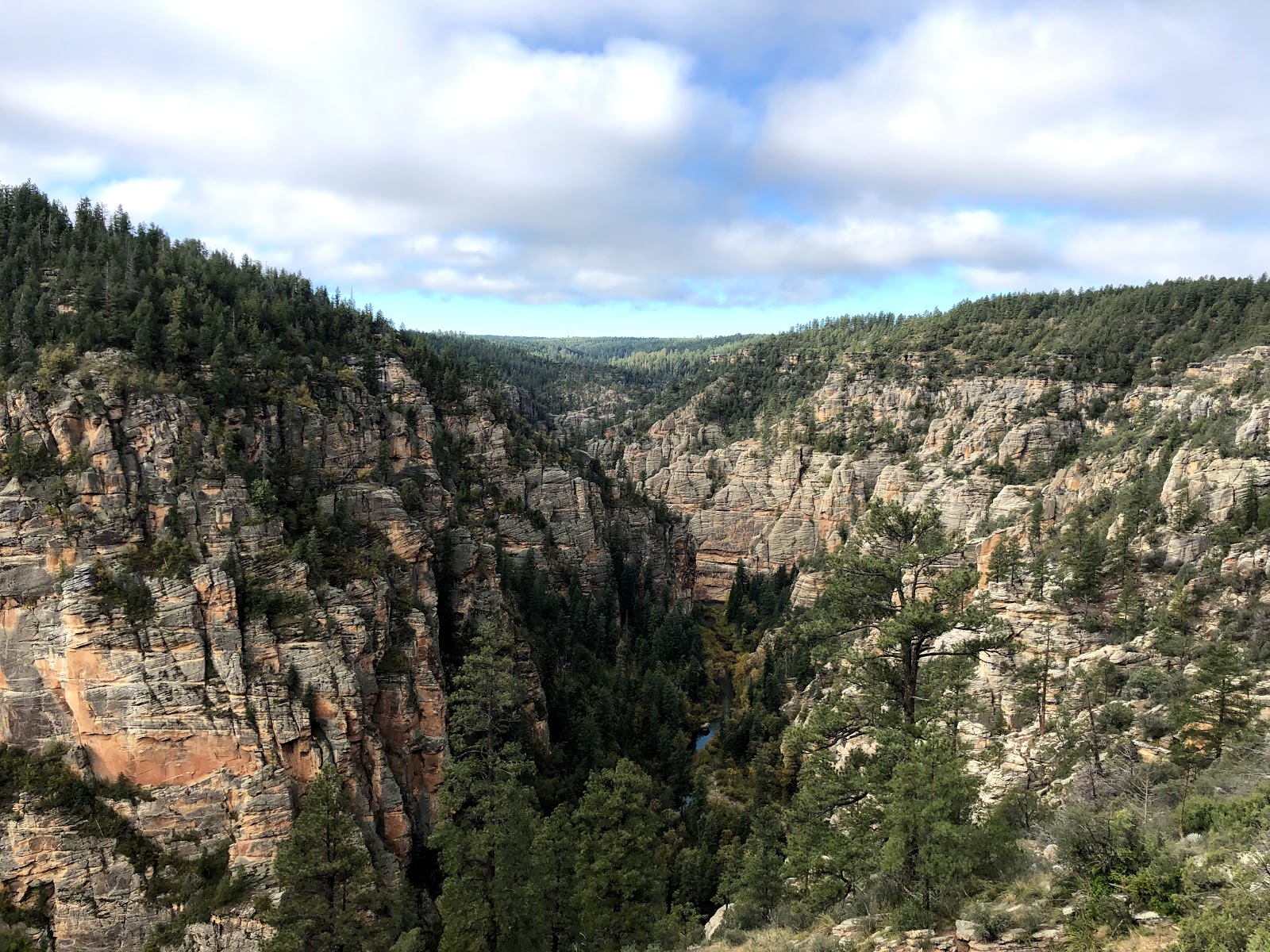
West Clear Creek:


Highline Trail:


Top of the Mogollon Rim:


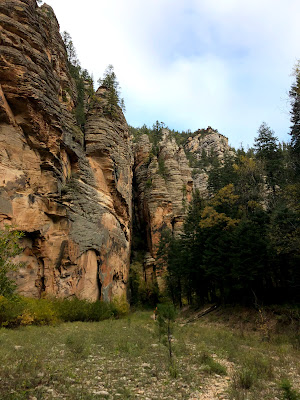
Blue Range Primitive Area:


Mogollon Mountains and Mineral Creek: